Drought and Saltwater Intrusion in the Mekong Delta: International Science, Local Adaptation
Originally published in Vietnamese by Nong Thon Viet. Digitised, translated and adapted for English-language publication by VASEA.
Sea-level rise, saltwater intrusion and increasingly severe dry-season drought are no longer distant threats to the Mekong Delta. They are already reshaping how water is managed, how food is produced and how millions of people plan for the future. As the delta continues to sink, coastlines erode, and freshwater flows become more uncertain, what was once treated as a seasonal challenge is becoming a defining question for the region’s long-term survival.
For generations, communities in the Mekong Delta have learned to live with water: its abundance, its rhythms and its risks. That local knowledge remains indispensable. But the pace and intensity of environmental change are now testing the limits of experience, infrastructure and policy developed under very different conditions. Without timely, coordinated and sufficiently ambitious responses, the consequences will extend far beyond individual farms or provinces, affecting livelihoods, food production, ecosystems and water security across the region.
To live in harmony with nature does not mean simply waiting for conditions to change and responding after the damage is done. It also means observing more carefully, understanding risks earlier and preparing before a crisis unfolds. Around the world, advances in remote sensing, environmental modelling, field sensors, artificial intelligence, resilient infrastructure and climate-smart agriculture are helping governments and communities make better-informed decisions. Yet international experience cannot simply be transferred wholesale. Any solution must be adapted to the Mekong Delta’s natural conditions, economy, institutions, farming systems and the everyday realities of the people who depend on them.
Across three interviews, this series brings together scientists and experts working in Australia and Vietnam to examine what that adaptation could look like in practice. They discuss how water-quality forecasting and satellite observations could support earlier warnings; how digital technologies, sensors and artificial intelligence could strengthen responses to flooding, saltwater intrusion and sea-level rise; and how water storage, agriculture, infrastructure and international standards might help communities build resilience over the longer term.
The challenge is not to eliminate drought or saltwater intrusion, phenomena that have long influenced the delta, but to prevent their increasing severity and reach from becoming unmanageable threats. For nearly 20 million people, the search for durable solutions is ultimately about more than technology. It is about protecting livelihoods, preserving choices, and creating sufficient knowledge, time, and capacity for communities to shape their own future. The hope is that, with science, preparation and locally grounded adaptation, communities across the Mekong Delta will be better able to anticipate drought and saltwater intrusion, reduce their impacts and adapt before they become crises.
Seeing the Salt Before It Arrives: Building an Early-Warning System for the Mekong Delta
Interviewed by Tuan Anh (Nong Thon Viet) and Maigan Thompson (CSIRO)
As these pressures increasingly affect communities and agricultural production, integrated systems that combine field observations, remote sensing, environmental modelling, digital technologies, and artificial intelligence are being explored as part of the response. Their value will depend not simply on technical sophistication, but on whether they can provide timely, trustworthy and understandable information to the people who must decide what to do next.
These decisions are being made across one of the world’s largest and most productive deltas. Covering approximately four million hectares, the Mekong Delta is home to extensive agricultural and aquaculture systems and millions of people whose livelihoods depend on the movement and availability of water. Much of the region is extremely low-lying, with elevations commonly around one metre above sea level, and about 94 per cent of its land is below two metres. This geography makes the delta particularly vulnerable to flooding, coastal change, and the intrusion of saltwater into rivers, canals, soils, and freshwater supplies.
Climate change and sea-level rise are intensifying these pressures, but they are not acting alone. Land subsidence, erosion along rivers and coastlines, changing rainfall patterns and declining dry-season river flows interact across the delta. Its dependence on the shared waters of the Mekong River adds a further layer of complexity, particularly between December and April, when freshwater flows are lower and demand for water remains high.
The difficulty is not only that these risks are growing. It is also that the information needed to respond is often fragmented across locations, technologies and institutions. A monitoring station can provide an accurate measurement at one point, but cannot describe conditions throughout an entire river and canal network. A satellite can observe large areas repeatedly, but cannot measure every relevant variable and may be limited by cloud cover. A model can estimate where a salt front may move next, but only when it is supported by reliable observations, sound scientific understanding and information about how the water system is being managed.
The opportunity, therefore, lies not in any single technology, but in connecting different sources of knowledge. In-water sensors can measure salinity, water level and other local conditions. Satellites can reveal broader patterns of flooding, sediment movement, vegetation stress and coastal change. Environmental models can simulate how water and salt move through the system, while artificial intelligence can help analyse large datasets, identify emerging patterns and update forecasts as new observations arrive.
From monitoring to early warning
Dr Duy Nguyen is an environmental modeller and fluid-dynamics scientist at CSIRO, Australia’s national science agency. Working across AquaWatch Australia and CSIRO’s water-security research, he is helping develop an integrated ground-to-space capability that combines field sensors, satellite observations, data systems and predictive modelling. AquaWatch is being developed towards a national water-quality monitoring and forecasting system designed to provide timely information and support better water-management decisions.
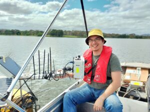
Photo: Installing a CSIRO HydraSpectra sensor at an urban lake. The field-deployed optical sensor measures the spectrum of light reflected from the water and forms part of AquaWatch’s broader system for detecting and forecasting changes in water quality.
Across Australia, AquaWatch is being tested and developed for a range of water-management challenges.
In South Australia’s Spencer Gulf, AquaWatch has been applied through a pilot project supporting an aquaculture industry worth approximately A$238 million a year. The work explores how field sensors, satellite observations and forecasting could provide operators with earlier information about changing water conditions.
At Grahamstown Dam in New South Wales, the system is being used to improve the monitoring of water quality and algal development in a major drinking-water reservoir. In Queensland, AquaWatch is examining how the Fitzroy River transports suspended sediment, dissolved substances and organic matter into Keppel Bay, which is connected to the southern Great Barrier Reef.
AquaWatch is also working with other CSIRO scientists and the South Australian Research and Development Institute (SARDI) to strengthen monitoring and forecasting capabilities for harmful algal blooms in South Australian waters. This collaboration draws on AquaWatch’s satellite and in-situ observing technologies alongside broader expertise in ocean observations, forecasting, and harmful algal bloom ecology.
Janet Anstee, Head of AquaWatch Australia and an aquatic remote-sensing scientist specialising in bio-optical modelling, said the system brings together different views of the same water body. High-precision field sensors provide frequent measurements at specific locations, while Earth-observation satellites reveal patterns across much larger areas.
The observations are brought together through AquaWatch’s data infrastructure, where data analytics, environmental models, and artificial intelligence developed by CSIRO scientists can be used to interpret current conditions and produce forecasts several days in advance.
Dr Duy Nguyen said timely water-quality information could support different decisions in different aquaculture systems. Operators might increase surveillance, adjust feeding, manage water intake or exchange, or take other protective action when conditions begin to deteriorate. In marine aquaculture, early warning may provide time to move pens or stock where operationally feasible; in pond-based systems, it may inform decisions about water intake, treatment, or exchange.
“Warm, calm and nutrient-rich conditions, particularly when water movement is limited, can favour rapid algal growth, ” Dr Nguyen said. “The important question is what happens before a bloom becomes visible. If we can identify the environmental conditions that precede it, operators may have more time to increase surveillance and prepare a response.”
AquaWatch scientists are working with research and industry partners to investigate how field sampling, optical measurements, satellite observations and environmental models can be combined to improve early warning. Not every algal bloom is toxic, and the factors controlling bloom development differ between species and locations. The aim is therefore to identify emerging risk and guide further investigation, rather than to treat every increase in algae as a confirmed harmful event.
Water colour contains valuable information, but the analysis does not rely on identifying a single shade of green. Multispectral and hyperspectral instruments measure how water reflects light across many wavelengths. Algorithms can use these spectral patterns to estimate indicators such as chlorophyll and suspended sediment, and to recognise changes that may be associated with increasing algal biomass.
“Rather than looking at colour alone, we analyse the spectrum of light reflected from the water,” Dr Nguyen explained. “Changes in photosynthetic pigments can indicate that algal biomass is increasing or that conditions may be developing towards a bloom. Satellite observations can show how widespread that change may be. At the same time, field measurements and laboratory analysis remain important for confirming what organisms are present and whether they pose a health or ecological risk.”
Dense blooms can also contribute to low-oxygen conditions. Algae respire, and when large quantities of algal material die, microbial decomposition can consume dissolved oxygen, placing fish and other aquatic organisms under stress.
Early warning can prompt targeted sampling and further assessment before water is used for drinking, agricultural production or aquaculture. Depending on the system and the nature of the risk, operators may then adjust water intakes, increase treatment, alter feeding or take other protective measures.
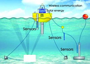
Photo: An example of an in-situ water-quality sensing system.
The same observational approach can be used to track materials transported from rivers into estuaries and coastal waters. At Keppel Bay, for example, AquaWatch is testing how field sensors and satellite imagery can track suspended sediment and dissolved organic carbon transported by the Fitzroy River.
In satellite imagery, high concentrations of suspended sediment may appear as brown plumes extending from the river mouth. Sediment is a natural part of river and coastal systems, but unusually high loads can reduce light penetration, affect seagrass and other marine habitats, and alter coastal ecological processes.
“Monitoring the movement of sediment can help identify areas of erosion and deposition, guide field investigations and inform broader catchment, riverbank and coastal-management planning,” Dr Nguyen said. “It can also help managers evaluate whether land- and water-management actions are improving downstream water quality.”
“AquaWatch is being designed to combine satellite observations with field measurements to build a more consistent, continental-scale picture of water quality,” Anstee said.
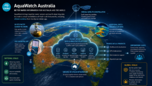
Photo: The AquaWatch technology is being applied in Australia. Photo credit: CSIRO AquaWatch.
The Australian technology demonstrates an architecture that could be adapted to the Mekong Delta: local sensors for frequent measurements, broader observations from satellites, environmental models for forecasting, and decision tools designed around the needs of farmers, water utilities and public agencies.
In the Mekong Delta, salinity in rivers, canals and aquaculture systems would primarily be measured using in-water conductivity or salinity sensors. These observations could be combined with information on river discharge, tides, rainfall, water levels and infrastructure operations in hydrodynamic models to forecast where the salt front may move and how long elevated salinity may persist.
Satellite imagery could provide complementary information about flooding, river plumes, sediment, vegetation stress, land use and coastal change across the wider delta. Artificial intelligence may help analyse large datasets, identify patterns or update forecasts as new observations arrive. The strength of the system would lie in combining these sources rather than expecting a single instrument to observe the entire problem.
Forecasts of salt-front movement could help farmers and aquaculture producers decide when to take water into fields or ponds, when to close an intake, and when to use stored freshwater or another source. The same information could support locally relevant maps and warnings showing how saltwater intrusion is expected to develop over the coming hours or days.
Local authorities and water utilities could use the forecasts to manage intake points, freshwater storage, blending, distribution or, where available, desalination and alternative supplies. Earlier information could help prevent highly saline water from entering parts of the supply system and support more timely warnings to communities.
Anstee said AquaWatch is being designed as a scalable system. Individual pilot sites test how the technology performs in specific environments, while the broader goal is to connect observations across regions and ultimately support national-scale water-quality information, planning and forecasting.
AquaWatch is currently supporting the development of a water-quality monitoring and forecasting system for aquaculture in Hai Phong, Vietnam. Similar capabilities have also been developed through projects in Malaysia, Indonesia and Thailand.
“We are proud to have developed HydraSpectra, a low-cost hyperspectral sensor that can be used in lower-income settings,” Anstee said. “This can help make advanced environmental-monitoring technology more accessible to countries and communities with limited resources.”
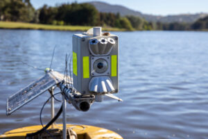
Photo: CSIRO’s HydraSpectra, a low-cost, field-deployed optical water-quality sensor that collects reflectance measurements above the water surface.
IoT-AI solutions for landslides and sea-level rise
Interviewed by Tuan Anh (Nong Thon Viet)
Professor Dzung Dao, Director of the Mechatronic Engineering Program at Griffith University in Australia, has proposed another technological approach to address sea-level rise and related risks in the Mekong Delta.
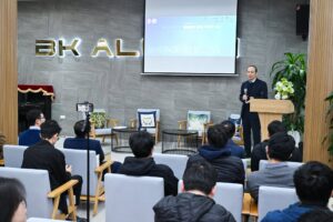
Photo: Professor Dao speaks with mechatronic engineering faculty and students at Hanoi University of Science and Technology.
The approach is based on an IoT-AI sensor network similar to systems installed in riverine and coastal areas of Australia, including parts of Queensland, to monitor flooding, landslides, and the condition of infrastructure. The network could also use sensors to monitor ground movement or changes in infrastructure at locations vulnerable to slope instability or erosion.
At the centre of the proposed system is the concept of a digital twin: a virtual representation of a physical environment or infrastructure system that is continually updated using observations from the real world. Artificial intelligence can then be used alongside environmental and engineering models to analyse the data, identify patterns and examine how conditions may change.
In practice, the system would combine satellite-derived information—including observations of sea level, waves, wind and coastal conditions—with data collected from ground-based sensor stations and drones. These observations could include water temperature, salinity, wind conditions, water levels and other environmental variables.
The information would be transmitted to a central processing platform in near real time. Artificial intelligence and modelling tools could then analyse the combined datasets, identify emerging patterns, generate forecasts and support authorities in issuing relevant warnings.
“We are proposing two principal technologies for an IoT sensor network in the Mekong Delta,” Professor Dao said. “The first is wireless communication, using protocols such as NB-IoT and LoRaWAN. The second is sensor technology based on microelectromechanical systems, or MEMS.”
He emphasised that the proposal was intended as an applied solution rather than a purely experimental research concept.
“Both technologies are already available in Vietnam,” he said. “MEMS technology, in particular, has been and continues to be developed by the Saigon Hi-Tech Park.”
Professor Dao said AI could provide rapid and practical support for managing the impacts of sea-level rise and related environmental hazards.
For example, data from salinity sensors, water-level stations and other observing systems could be analysed to help forecast where and when saltwater intrusion may occur. Digital models could then simulate the movement of saline water through rivers and canals, and support preventive planning.
According to Professor Dao, the same approach could be used to assess how sea-level rise may affect agricultural land and critical infrastructure. It could help authorities optimise transport routes and storage systems, identify early signs of damage to technical equipment, and estimate when maintenance may be required.
AI-supported modelling could also assist in assessing the design and location of protective structures such as dykes, embankments and barriers. Such tools would support, rather than replace, the detailed engineering, environmental and economic assessments required for infrastructure development.
“Models could also be used to examine how sea-level rise may affect drainage and water-supply systems. Over time, this information could help water managers adjust drainage and supply operations in response to forecasts produced several hours in advance,” said Professor Dao.
“Similar technologies have also been tested in Ho Chi Minh City. In 2023, more than 50 flood-monitoring sensor stations were installed in Thu Duc City and Nha Be District through an Australian Government-funded initiative implemented by the Ho Chi Minh City Department of Science and Technology,” said Professor Dao.
Through this system, residents can receive real-time flood warnings through a mobile application, improving public safety and providing authorities and communities with more timely information.
A range of related technologies and research programs is already being explored in Vietnam.
These include flood- and salinity-protection measures for cities such as Can Tho; the construction of tidal-flood defences, including ring dykes and pumping stations; and the integration of flood risk into urban and transport planning.
Other approaches include adapting Dutch rainwater-harvesting technologies to provide water for drinking and domestic use, developing methods to treat polluted or saline water, and installing automated sensor systems to monitor water quality in aquaculture ponds. Some of these systems have already been introduced at facilities in Ca Mau and other Mekong Delta provinces.
“For the Mekong Delta, no single technology will eliminate the risks created by climate change, subsidence, sea-level rise and saltwater intrusion. However, by combining satellite observations, field sensors, digital twins, environmental models and artificial intelligence, authorities may be able to understand these risks earlier, respond more effectively and make better-informed decisions about the region’s water future,” Dr Duy Nguyen said.
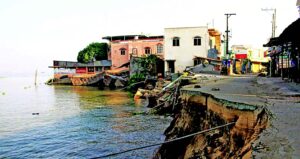
Photo: Riverbank and coastal erosion are becoming increasingly severe in the Mekong Delta. Photo credit: Nong Thon Viet.
Perspectives from Vietnamese Experts in Australia
Written by Anh Khoi (Nong Thon Viet).
Vietnamese academics and professionals from leading Australian universities and research institutions are working together to identify practical ways to respond to sea-level rise, drought and saltwater intrusion in the Mekong Delta. Their efforts have been coordinated through the Association of Vietnamese Experts and Scholars in Queensland, or AVESQ, and the Vietnamese Australian Scholars and Experts Association, or VASEA, with contributions from Vietnam’s Directorate for Standards, Metrology and Quality, relevant provincial agencies across the Mekong Delta, and specialists based in Vietnam.
Whatever their field of expertise, their perspectives share one common thread: a deep concern for the future of their homeland.
Dr Pham Thu Hien, a senior research scientist at Australia’s national science agency, CSIRO, initiated an Australian science and technology research effort focused on drought and salinity intrusion in the Mekong Delta.
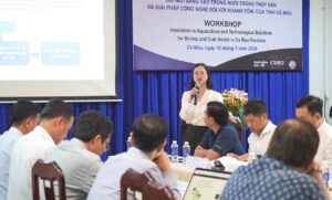
Photo: Dr Pham Thu Hien from CSIRO shared insights into challenges facing the Vietnamese shrimp industry, including environmental and market challenges, the technical and social responsibility requirements imposed by importing countries, and innovative solutions applicable to Vietnam. Photo credit: Australian Embassy, Vietnam.
“Everything began with a working visit to Ca Mau, Can Tho and Soc Trang under the Aus4Innovation partnership between Australia and Vietnam,” Dr Pham said.
“After meeting government agencies at both central and local levels, and speaking directly with local communities, I was able to develop a much clearer understanding of the challenges facing the Mekong Delta as a result of sea-level rise and saltwater intrusion. These are also issues of significant interest to CSIRO.”
According to Dr Pham, CSIRO is supporting efforts to help the Mekong Delta’s shrimp industry become more sustainable and better adapted to climate change. The broader aim is to strengthen Vietnam’s capacity to respond to climate-related pressures through applied research.
Following her call for collaboration, more than 30 Vietnamese experts working at universities across Australia established four specialist groups focused on water management, agriculture, infrastructure, and data-driven solutions using digital technologies.
Professor Long Nghiem, Director of the Centre for Technology in Water and Wastewater at the University of Technology Sydney, said that Australia has developed a wide range of effective water-saving technologies. Still, not all of them can be transferred directly to Vietnam due to differences in infrastructure and economic conditions.
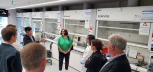
Photo: Professor Long Nghiem and his research group welcomed UTS Councils to the Centre for Technology in Water and Wastewater.
He proposed a low-cost water-storage solution using flexible thermoplastic polyurethane, or TPU, tanks for household use, combined with ceramic membrane filtration to help maintain freshwater supplies in the Mekong Delta.
In agriculture, Dr Linh Hoang of the University of Queensland proposed integrating greenhouse-gas reduction into existing models for living with drought and salinity intrusion.
“Many adaptive models have already been applied effectively in the Mekong Delta, including the rice–shrimp farming system,” Dr Hoang said.
“However, in addition to adapting to salinity, we should actively research, improve and expand production models that reduce greenhouse-gas emissions or increase the capture and storage of carbon in crops, while also creating products with higher economic value and lower environmental impact.”
One option, she explained, would be to incorporate carbon sequestration into agricultural production. This could include selecting salt-tolerant rice varieties suited to changing environmental conditions, together with irrigation and cultivation practices designed to reduce methane and other greenhouse-gas emissions.
She also proposed applying zero-discharge shrimp-farming systems and using cleaner technologies to convert rice husks and straw into nanocarbon materials for filtering and reusing water within rice–shrimp farming systems.
Dr Hoang argued that Vietnam should develop standards for carbon-neutral products—those produced without net greenhouse gas emissions, or in which emissions are balanced by carbon removal. Such standards could increase the value and competitiveness of Vietnamese agricultural products in international markets.
Land subsidence poses another severe threat to the Mekong Delta. It can contribute to the loss of residential and agricultural land and intensify the effects of flooding, sea-level rise and salinity.
The Structures and Buildings Group, coordinated by Professor Tuan Ngo (the Research Program Leader of the Building Transformation of the Building 4.0 CRC at the University of Melbourne), is examining materials and structural designs that could reduce the effects of natural hazards, including weak ground conditions caused by subsidence and exposure to saline environments.

Photo: Professor Tuan Ngo works with university, industry and government partners to make buildings more sustainable, faster and cheaper to build. Photo credit: the University of Melbourne.
Professor Ngo hopes to develop construction materials using locally available resources or recycled building waste. These materials could be used for new construction and to strengthen existing infrastructure across the delta, while also supporting a greener, more circular construction economy.
He noted that sea-level rise and saltwater intrusion are not unique to Vietnam. Many countries face similar pressures, and Vietnam should actively exchange knowledge with Australia and other nations to identify solutions suited to its own economic, social and environmental conditions.
Professor Dzung Dao of Griffith University coordinates the group working on data-driven solutions through digital technology.
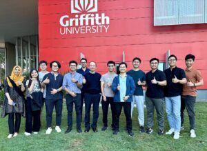
Photo: Professor Dao’s group at Griffith University, as of Dec 2025.
The group is exploring how the Internet of Things, or IoT, can be combined with artificial intelligence to improve the collection and analysis of real-world data. These data can then support the other specialist groups and help local authorities strengthen environmental monitoring and forecasting.
Professor Dao’s research team has worked with Ho Chi Minh City for several years on wireless networks of miniature sensors that monitor urban flooding in real time.
He hopes that the experience gained from developing intelligent flood-warning systems in Ho Chi Minh City can be extended to technologies tailored to the Mekong Delta’s specific environmental conditions.
The work of these experts reflects a broader principle: technology alone will not solve the delta’s problems. Effective solutions must combine scientific knowledge, local experience, appropriate infrastructure, reliable data and policies that can be implemented in practice.
The experts may now live and work far from Vietnam, but their research remains closely connected to the country. Their efforts are driven not only by professional expertise, but also by a shared desire to contribute to the long-term resilience of the Mekong Delta and the communities whose futures depend on it.
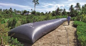
Photo: Freshwater storage bags offer a practical way to adapt to drought and salinity intrusion. Photo credit: Nong Thon Viet.
